
ISBN: 9781566953771
• Waterproof • Tear-Resistant • Topographic MapExpertly researched and created in cooperation with the U.S. Forest Service, Bureau of Land Management and others, National G… Más…
| BarnesandNoble.com new in stock. Gastos de envío:zzgl. Versandkosten., más gastos de envío Details... |

Manti La Sal National Forest Trails Illustrated Other Rec Areas National Geographic Trails Illustrated Map - Pasta blanda
2008, ISBN: 9781566953771
Softcover, New Book. Shipped from UK in 4 to 14 days. Established seller since 2000. Please note we cannot offer an expedited shipping service from the UK., [PU: National Geographic Maps … Más…
| alibris.co.uk |

2008, ISBN: 1566953774
[EAN: 9781566953771], Nouveau livre, [SC: 11.71], [PU: Natl Geographic Society Maps], map edition. 2 pages. 0.25x9.25x4.25 inches. In Stock., Maps
| AbeBooks.fr Revaluation Books, Exeter, United Kingdom [2134736] [Note: 5 (sur 5)] NEW BOOK. Gastos de envío: EUR 11.71 Details... |
2020, ISBN: 1566953774
[EAN: 9781566953771], Nouveau livre, [SC: 19.16], [PU: Natl Geographic Society Maps], Book is in NEW condition., Books
| AbeBooks.fr GF Books, Inc., Hawthorne, CA, U.S.A. [64674448] [Note: 5 (sur 5)] NEW BOOK. Gastos de envío: EUR 19.16 Details... |

2012, ISBN: 9781566953771
Trails Illustrated Other Rec. Areas, Karte/Globus, Karte (gefalzt), 2008th Revised ed. [PU: National Geographic Maps], National Geographic Maps, 2012
| lehmanns.de Gastos de envío:Versand in 7-10 Tagen. (EUR 0.00) Details... |

ISBN: 9781566953771
• Waterproof • Tear-Resistant • Topographic MapExpertly researched and created in cooperation with the U.S. Forest Service, Bureau of Land Management and others, National G… Más…

National Geographic Maps:
Manti La Sal National Forest Trails Illustrated Other Rec Areas National Geographic Trails Illustrated Map - Pasta blanda2008, ISBN: 9781566953771
Softcover, New Book. Shipped from UK in 4 to 14 days. Established seller since 2000. Please note we cannot offer an expedited shipping service from the UK., [PU: National Geographic Maps … Más…
2008
ISBN: 1566953774
[EAN: 9781566953771], Nouveau livre, [SC: 11.71], [PU: Natl Geographic Society Maps], map edition. 2 pages. 0.25x9.25x4.25 inches. In Stock., Maps
2020, ISBN: 1566953774
[EAN: 9781566953771], Nouveau livre, [SC: 19.16], [PU: Natl Geographic Society Maps], Book is in NEW condition., Books
2012, ISBN: 9781566953771
Trails Illustrated Other Rec. Areas, Karte/Globus, Karte (gefalzt), 2008th Revised ed. [PU: National Geographic Maps], National Geographic Maps, 2012
Datos bibliográficos del mejor libro coincidente

| Autor: | |
| Título: | |
| ISBN: |
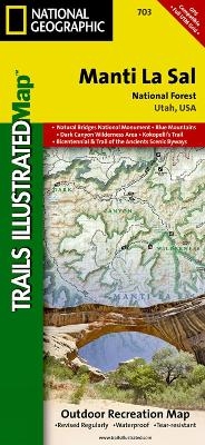
• Waterproof • Tear-Resistant • Topographic Map
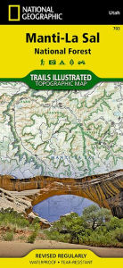
Expertly researched and created in cooperation with the U.S. Forest Service, Bureau of Land Management and others, National Geographic’s Trails Illustrated map of Manti-La Sal National Forest provides unmatched detail of the discontiguous Moab and Monticello Ranger District areas of the forest. The map covers map popular points of interest, including Dark Canyon Wilderness, Natural Bridges National Monument, Blue Mountains and Cheesebox Canyon.
Outdoor enthusiasts will be able to get off the beaten track and back on again by following the map to clearly marked trailheads and then along precisely mapped trails, labeled either for hiking, motorcycle or ATV use, including The Kokopelli Trail. Trails in the Moab Ranger District also have mileage indicators. To assist in your navigation of the area, the map shows contour lines, elevations, labeled peaks, water features, selected waypoints and numbered Forest Service roads. Recreation features include areas for camping, boat launching, water skiing and fishing. The Unaweep-Tabeguache, Bicentennial and Trail of the Ancients Scenic Byways are also all marked.
Every Trails Illustrated map is printed on "Backcountry Tough" waterproof, tear-resistant paper. A full UTM grid is printed on the map to aid with GPS navigation.
Other features found on this map include: Abajo Mountains, Abajo Peak, Bears Ears, Canyonlands National Park, Dark Canyon Wilderness, Glen Canyon National Recreation Area, Grand Gulch Plateau, La Sal Mountains, Manti-La Sal National Forest, Mount Peale, Paradox Valley.
Map Scale = 1:70,000Sheet Size = 37.75" x 25.5"Folded Size = 4.25" x 9.2Detalles del libro - Manti La Sal National Forest
EAN (ISBN-13): 9781566953771
ISBN (ISBN-10): 1566953774
Tapa blanda
Año de publicación: 2010
Editorial: National Geographic Maps
2 Páginas
Peso: 0,091 kg
Idioma: eng/Englisch
Libro en la base de datos desde 2011-04-15T11:12:59+02:00 (Madrid)
Página de detalles modificada por última vez el 2023-06-18T00:33:05+02:00 (Madrid)
ISBN/EAN: 1566953774
ISBN - escritura alterna:
1-56695-377-4, 978-1-56695-377-1
Mode alterno de escritura y términos de búsqueda relacionados:
Autor del libro: national geographic maps
Título del libro: national geographic, 703, sal
Más, otros libros, que pueden ser muy parecidos a este:
Último libro similar:
0749717017030 Manti-La Sal National Forest Map: Trails Illustrated Other Rec. Areas (National Geographic Trails Illustrated Map) (National Geographic Maps)
- 0749717017030 Manti-La Sal National Forest Map: Trails Illustrated Other Rec. Areas (National Geographic Trails Illustrated Map) (National Geographic Maps)
- 0749717002630 Grand Canyon West, AZ: NATIONAL GEOGRAPHIC Trails Illustrated National Parks: Outdoor Recreation Map. Grand Canyon National Park Arizona, USA (National Geographic Trails Illustrated Map, Band 263) (National Geographic Maps)
- 9785512815359 Manti-La Sal National Forest (Jesse Russell, Ronald Cohn)
- 9786131701399 Manti-La Sal National Forest (Miller, Frederic P. (Hrsg.) / Vandome, Agnes F. (Hrsg.) / McBrewster, John (Hrsg.))
< para archivar...