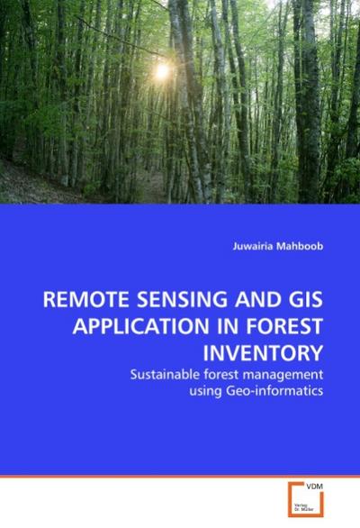
Juwairia Mahboob:REMOTE SENSING AND GIS APPLICATION IN FOREST INVENTORY : Sustainable forest management using Geo-informatics
- Pasta blanda 2011, ISBN: 3639328590
[EAN: 9783639328592], Neubuch, [PU: VDM Verlag Dr. Müller], nach der Bestellung gedruckt Neuware - Printed after ordering - Forest inventories have traditionally been used for acquiring q… Más…
[EAN: 9783639328592], Neubuch, [PU: VDM Verlag Dr. Müller], nach der Bestellung gedruckt Neuware - Printed after ordering - Forest inventories have traditionally been used for acquiring quantitative and qualitative information of forests. With the advent of technology, remote sensing has been found to provide an alternative for forest mapping and monitoring in less time and low cost. This research involves the study of forest crown closure, type of tree species and their spatial distribution in Ayubia National Park with SPOT 5 (2.5m spatial resolution) & ALI (30m spatial resolution) imageries based on the collaboration of Geographic Information System and Remote Sensing. In this study the optical properties of tree species were used to classify the study area into different vegetation categories. Being different and unique for each species, optical properties were used as a source of species identification. Species classification was performed using various supervised classification methods, both on high spectral (ALI) and spatial (SPOT) resolution multispectral space borne imageries. 112 pp. Deutsch, Books<
| | AbeBooks.deAHA-BUCH GmbH, Einbeck, Germany [51283250] [Rating: 5 (von 5)] NEW BOOK. Gastos de envío:Versandkostenfrei. (EUR 0.00) Details... |
(*) Libro agotado significa que este título no está disponible por el momento en alguna de las plataformas asociadas que buscamos.

Mahboob, Juwairia:REMOTE SENSING AND GIS APPLICATION IN FOREST INVENTORY
- Pasta blanda 2011, ISBN: 9783639328592
[ED: Softcover], [PU: VDM Verlag Dr. Müller], Forest inventories have traditionally been used for acquiring quantitative and qualitative information of forests. With the advent of technol… Más…
[ED: Softcover], [PU: VDM Verlag Dr. Müller], Forest inventories have traditionally been used for acquiring quantitative and qualitative information of forests. With the advent of technology, remote sensing has been found to provide an alternative for forest mapping and monitoring in less time and low cost. This research involves the study of forest crown closure, type of tree species and their spatial distribution in Ayubia National Park with SPOT 5 (2.5m spatial resolution) & ALI (30m spatial resolution) imageries based on the collaboration of Geographic Information System and Remote Sensing. In this study the optical properties of tree species were used to classify the study area into different vegetation categories. Being different and unique for each species, optical properties were used as a source of species identification. Species classification was performed using various supervised classification methods, both on high spectral (ALI) and spatial (SPOT) resolution multispectral space borne imageries.
2011. 112 S. 220 mm
Versandfertig in 6-10 Tagen, DE, [SC: 0.00], Neuware, gewerbliches Angebot, Offene Rechnung (Vorkasse vorbehalten)<
| | booklooker.debuecher.de GmbH & Co. KG Gastos de envío:Versandkostenfrei, Versand nach Deutschland. (EUR 0.00) Details... |
(*) Libro agotado significa que este título no está disponible por el momento en alguna de las plataformas asociadas que buscamos.

Juwairia Mahboob:REMOTE SENSING AND GIS APPLICATION IN FOREST INVENTORY
- Pasta blanda 2011, ISBN: 3639328590
[EAN: 9783639328592], Neubuch, [PU: VDM Verlag Dr. Müller], This item is printed on demand - it takes 3-4 days longer - Neuware -Forest inventories have traditionally been used for acquir… Más…
[EAN: 9783639328592], Neubuch, [PU: VDM Verlag Dr. Müller], This item is printed on demand - it takes 3-4 days longer - Neuware -Forest inventories have traditionally been used for acquiring quantitative and qualitative information of forests. With the advent of technology, remote sensing has been found to provide an alternative for forest mapping and monitoring in less time and low cost. This research involves the study of forest crown closure, type of tree species and their spatial distribution in Ayubia National Park with SPOT 5 (2.5m spatial resolution) & ALI (30m spatial resolution) imageries based on the collaboration of Geographic Information System and Remote Sensing. In this study the optical properties of tree species were used to classify the study area into different vegetation categories. Being different and unique for each species, optical properties were used as a source of species identification. Species classification was performed using various supervised classification methods, both on high spectral (ALI) and spatial (SPOT) resolution multispectral space borne imageries. 112 pp. Deutsch, Books<
| | AbeBooks.deBuchWeltWeit Inh. Ludwig Meier e.K., Bergisch Gladbach, Germany [57449362] [Rating: 5 (von 5)] NEW BOOK. Gastos de envío:Versandkostenfrei. (EUR 0.00) Details... |
(*) Libro agotado significa que este título no está disponible por el momento en alguna de las plataformas asociadas que buscamos.

Juwairia Mahboob:Mahboob, J: Remote Sensing and Gis Application in Forest Inv
- Pasta blanda ISBN: 9783639328592
Forest inventories have traditionally been used for acquiring quantitative and qualitative information of forests. With the advent of technology, remote sensing has been found to provide … Más…
Forest inventories have traditionally been used for acquiring quantitative and qualitative information of forests. With the advent of technology, remote sensing has been found to provide an alternative for forest mapping and monitoring in less time and low cost. This research involves the study of forest crown closure, type of tree species and their spatial distribution in Ayubia National Park with SPOT 5 (2.5m spatial resolution) & ALI (30m spatial resolution) imageries based on the collaboration of Geographic Information System and Remote Sensing. In this study the optical properties of tree species were used to classify the study area into different vegetation categories. Being different and unique for each species, optical properties were used as a source of species identification. Species classification was performed using various supervised classification methods, both on high spectral (ALI) and spatial (SPOT) resolution multispectral space borne imageries. Bücher 22.3 cm x 15.4 cm x 1.2 cm mm , VDM, Taschenbuch, VDM<
| | Orellfuessli.chNr. A1016879547. Gastos de envío:Lieferzeiten außerhalb der Schweiz 3 bis 21 Werktage, , in stock, zzgl. Versandkosten. (EUR 18.23) Details... |
(*) Libro agotado significa que este título no está disponible por el momento en alguna de las plataformas asociadas que buscamos.
Juwairia Mahboob:REMOTE SENSING AND GIS APPLICATION IN FOREST INVENTORY
- Primera edición 2011, ISBN: 9783639328592
Pasta dura
[ED: Kartoniert / Broschiert], [PU: VDM Verlag Dr. Mueller], Dieser Artikel ist ein Print on Demand Artikel und wird nach Ihrer Bestellung fuer Sie gedruckt. Autor/Autorin: Mahboob Juwair… Más…
[ED: Kartoniert / Broschiert], [PU: VDM Verlag Dr. Mueller], Dieser Artikel ist ein Print on Demand Artikel und wird nach Ihrer Bestellung fuer Sie gedruckt. Autor/Autorin: Mahboob JuwairiaShe did her B.Sc and M.Sc in forestry from Pakistan Forest Institute Peshawar and did her MS in remote sensing and GIS from Natio, DE, [SC: 0.00], Neuware, gewerbliches Angebot, Hardcover, 112, [GW: 177g], 1. Auflage, Banküberweisung, PayPal<
| | booklooker.deMoluna GmbH Gastos de envío:Versandkostenfrei, Versand nach Deutschland. (EUR 0.00) Details... |
(*) Libro agotado significa que este título no está disponible por el momento en alguna de las plataformas asociadas que buscamos.


